
by Pinkbike.com
Detailed Review
Key Features
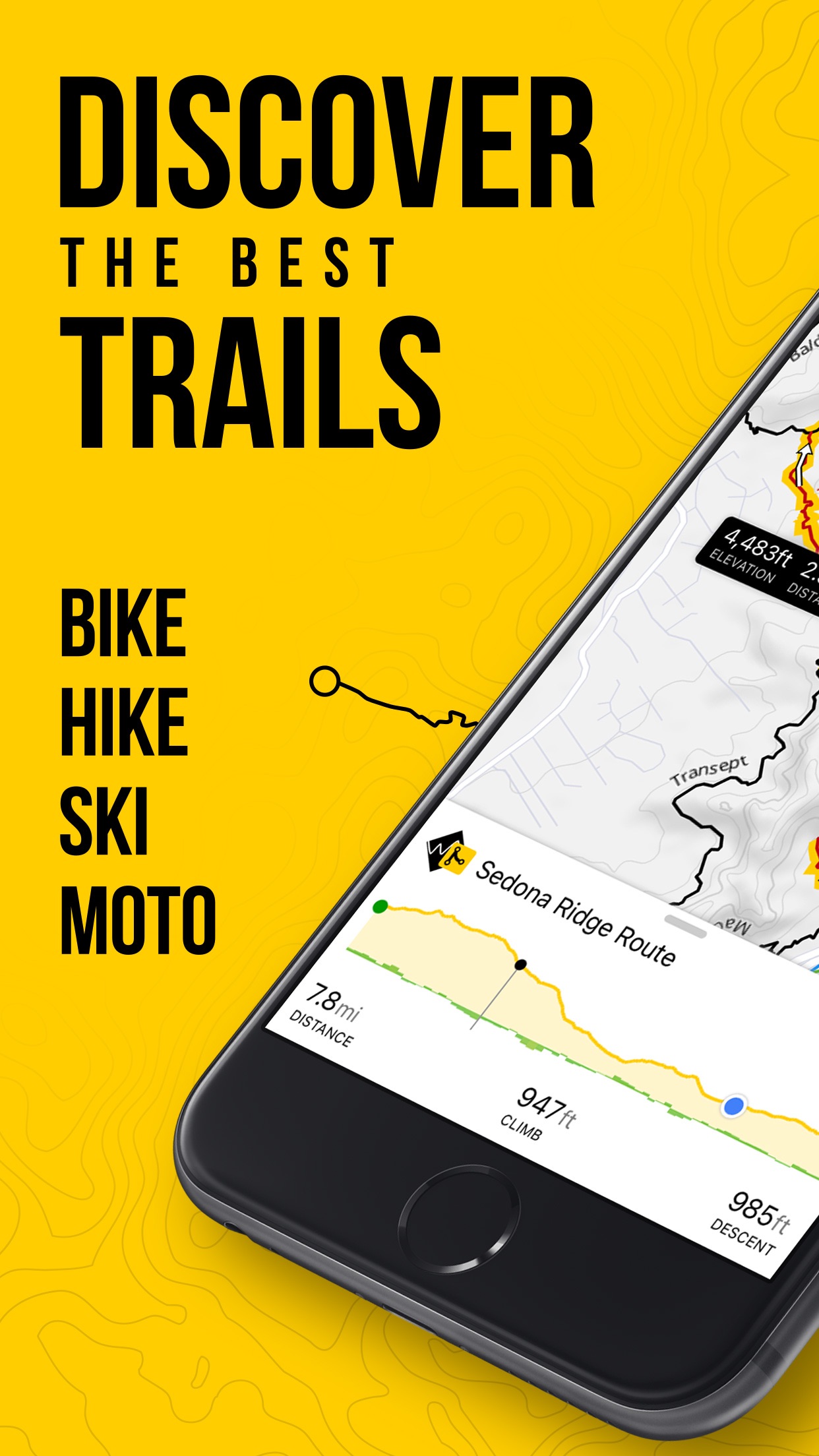
- •Offline trail maps allowing navigation without cellular service in remote riding locations
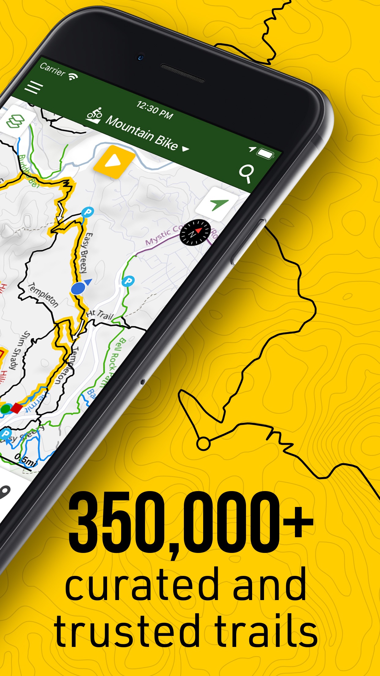
- •Community-curated database with over 650,000 trails verified by local associations
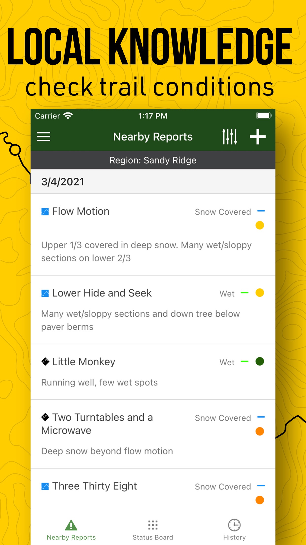
- •Color-coded difficulty rating system helping riders identify appropriate trails quickly
- •Integration with Garmin devices enabling synchronized navigation across bike computers
- •Comprehensive points of interest including trailheads, features, and amenities
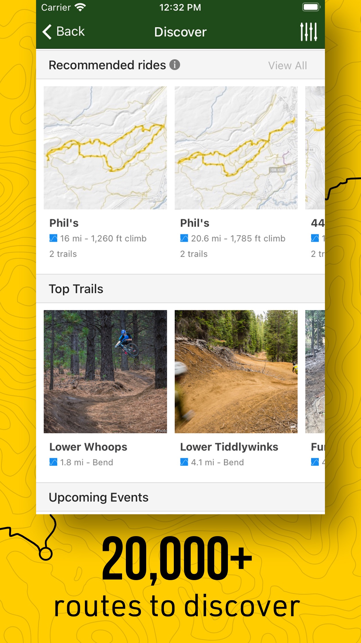
- •Regional download system conserving device storage while maintaining access to needed areas
Why Users Love It
Perfect for: Mountain bikers seeking reliable trail information and navigation
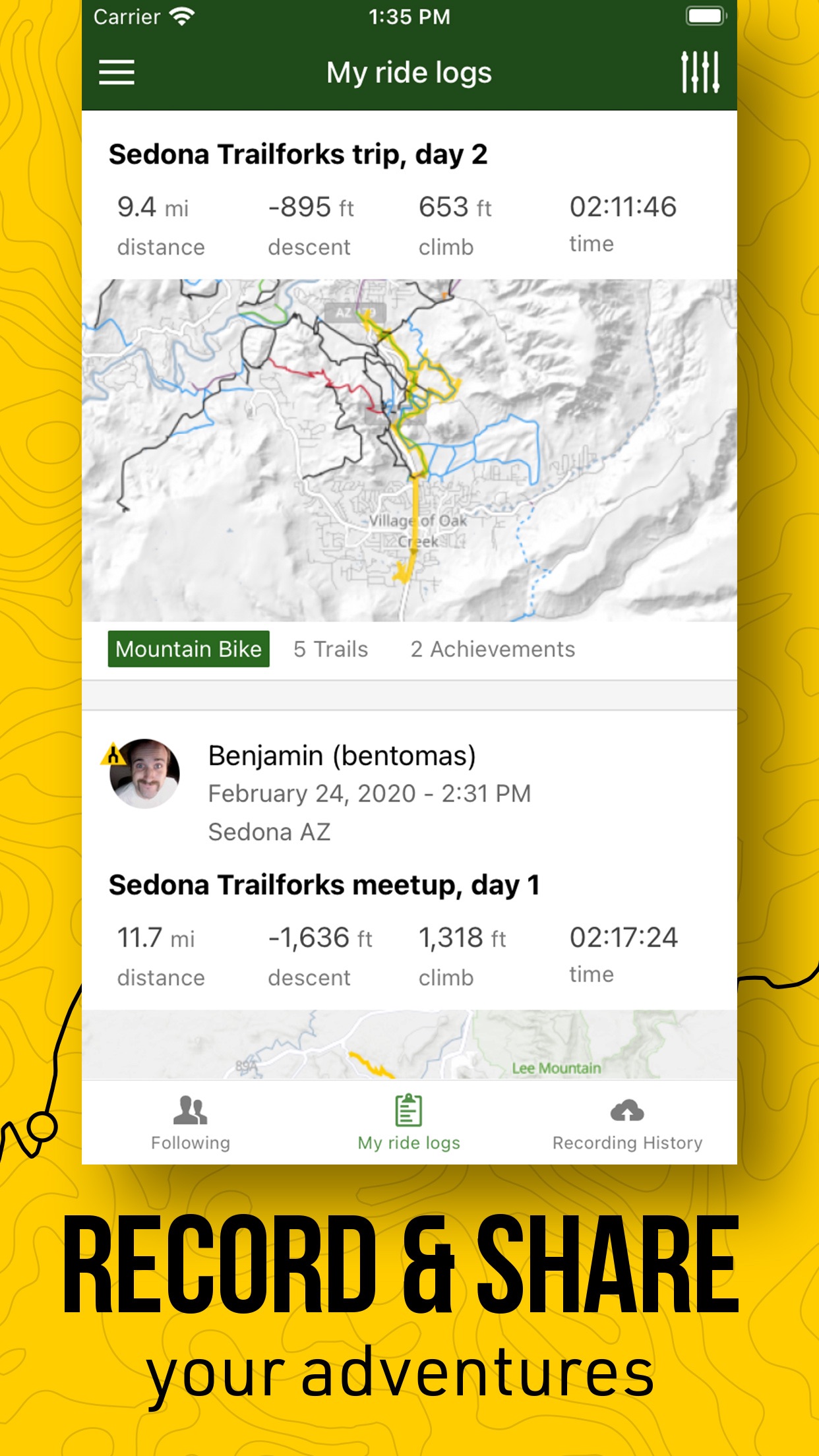
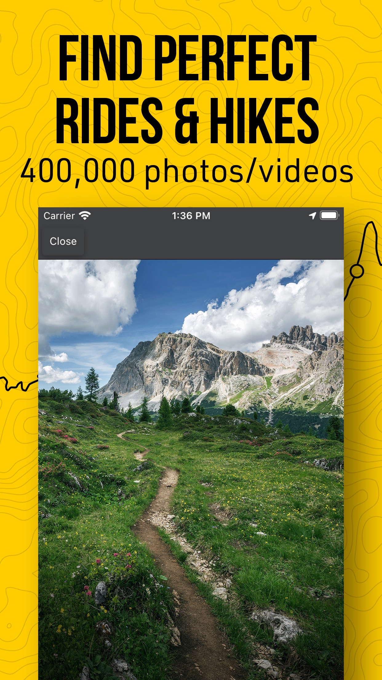
Screenshots
User Reviews
A stranger recommended this to me while I was actively on a trail. Thanks, Josh! Recommended A stranger recommended this to me while I was actively on a trail. Thanks, Josh!
There’s certainly not a better paid app for mountain bike trails out there. Some of the other freebies that are user contributed just don’t seem to cut it. Plenty of data plenty of ride recommendations and plenty of ways to look up the most popular trails in any given. Great MTB Trails App There’s certainly not a better paid app for mountain bike trails out there. Some of the other freebies that are user contributed just don’t seem to cut it. Plenty of data plenty of ride recommendations and plenty of ways to look up the most popular trails in any given.
Trailforks is my go to routing software for mountain biking. It’s great for exploring new areas while planning a trip! Best MTB trail software ever! Trailforks is my go to routing software for mountain biking. It’s great for exploring new areas while planning a trip!
I use the app a lot not just while riding, but in trip planning to find places to stay / camp near where I want to ride. Great tool! Great to help plan trips I use the app a lot not just while riding, but in trip planning to find places to stay / camp near where I want to ride. Great tool!
Without Trailforks I wouldn’t know where to go or what would be a good level trail for me to try. It’s invaluable when on bike vacations. The rating system of green, blue, black is relative to the trail system you are riding, but it’s better than nothing. New to MTB so I needed maps and ideas of where to ride Without Trailforks I wouldn’t know where to go or what would be a good level trail for me to try. It’s invaluable when on bike vacations. The rating system of green, blue, black is relative to the trail system you are riding, but it’s better than nothing.
App Details
Developer
Pinkbike.com
Platform
iosRating
Last Updated
9/7/2025
Other Navigation Apps
Waze Navigation & Live Traffic
Waze Inc.
ParkMobile: Park. Pay. Go.
Parkmobile USA, Inc.
Transit • Subway & Bus Times
Transit App, Inc.
Shell: Fuel, Charge & More
Shell Information Technology International B.V.
SpotHero: #1 Rated Parking App
SpotHero, Inc.
ParkWhiz - #1 Parking App
ParkWhiz, Inc.