
by The Ohio Department of Transportation
Detailed Review
Key Features
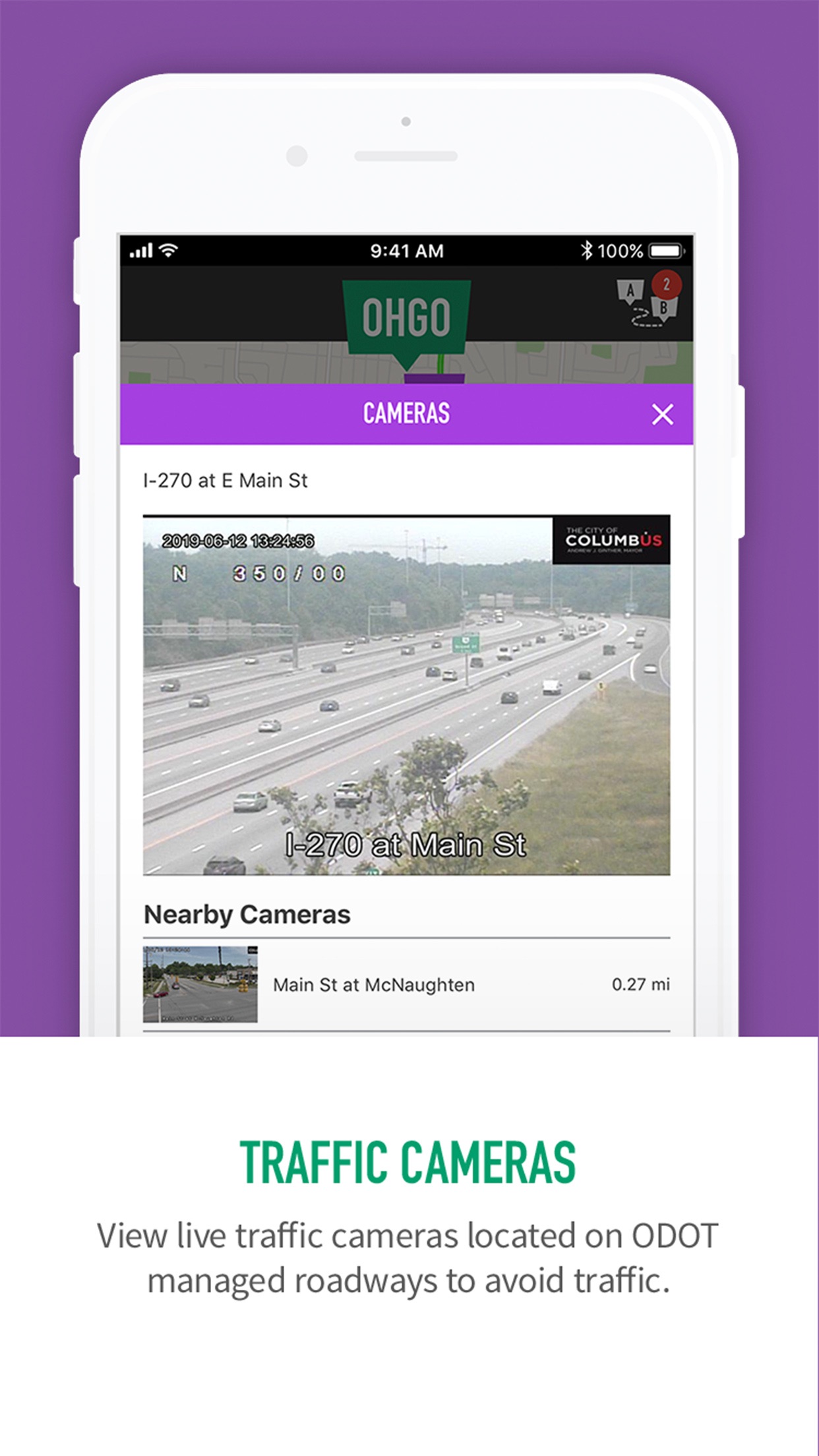
- •Live Traffic Cameras: Access a vast network of ODOT highway cameras for visual confirmation of road conditions, congestion, and weather impacts on specific routes.
- •Interactive Traffic Map: View real-time traffic speeds, accidents, road construction, and other hazards overlaid on a detailed map of Ohio's roadways.
- •Saved Routes & Favorites: Save frequently traveled routes and bookmark specific cameras for quick, one-tap access to relevant commute information.
- •Official Construction Alerts: Receive information on active and planned construction zones directly from the Ohio Department of Transportation's schedules.
- •Travel Time Information: Check estimated travel times on major highways, though this may rely on traffic flow data rather than personalized routing.
- •Incident and Hazard Reporting: See user-reported and officially confirmed incidents like crashes, debris, and lane closures.
Why Users Love It
Perfect for: Ohio-based commuters and travelers who need reliable, detailed information on state highway conditions.
Screenshots


User Reviews
A lot more features than I expected! Working on my iPhone XR as of 2/3/22 A lot more features than I expected!
I love this app. I live 30mins (in no traffic) from my place of work. There is a lot of construction between my house and Columbus. This also adds to accidents. This app uses ODOT info and other app info to give you up-to-date info on why you are sitting in a parking lot on a freeway. Seriously, try googling with Siri to find out if you should reroute, stay the path, or even switch lanes. You will be lucky to find any of that. This app tells you everything you need to be on time and safe! I highly recommend this app for daily commutes and trips in Ohio. I use this app daily! I love this app. I live 30mins (in no traffic) from my place of work. There is a lot of construction between my house and Columbus. This also adds to accidents. This app uses ODOT info and other app info to give you up-to-date info on why you are sitting in a parking lot on a freeway. Seriously, try googling with Siri to find out if you should reroute, stay the path, or even switch lanes. You will be lucky to find any of that. This app tells you everything you need to be on time and safe! I highly recommend this app for daily commutes and trips in Ohio.
Great app to see the traffic conditions before heading out or leaving. And I like that you can see hazards, construction, etc on the map as well! Great work ODOT! Awesome app to see live traffic! Great app to see the traffic conditions before heading out or leaving. And I like that you can see hazards, construction, etc on the map as well! Great work ODOT!
I don't get the bad reviews. This app is awesome. Maybe it's you? Awesome Resource I don't get the bad reviews. This app is awesome. Maybe it's you?
Although there have been problems with previous versions, the latest version is working perfectly on my iPhone 13. Use the cameras often to check road conditions. OHGO working great Although there have been problems with previous versions, the latest version is working perfectly on my iPhone 13. Use the cameras often to check road conditions.
App Details
Developer
The Ohio Department of Transportation
Platform
iosRating
Last Updated
12/15/2025