by Garmin
Detailed Review
Key Features
- •Offline vector charts with detailed depth contours and navigational markers for reliable navigation without cellular coverage
- •SonarChart Live community mapping that aggregates user depth readings to continuously improve chart accuracy
- •Advanced route planning with automatic routing that considers water depth, bridges, and navigational restrictions
- •Real-time weather overlays and tide predictions providing essential environmental information for trip planning
- •AIS integration capability for viewing marine traffic and enhancing collision avoidance during navigation
- •Fishing features including depth shading, water temperature layers, and fishing calendar for angler optimization
Why Users Love It
Perfect for: Serious boaters, anglers, and sailors requiring professional navigation features
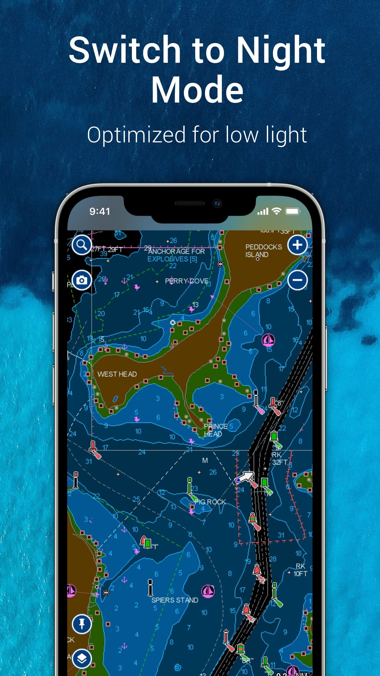
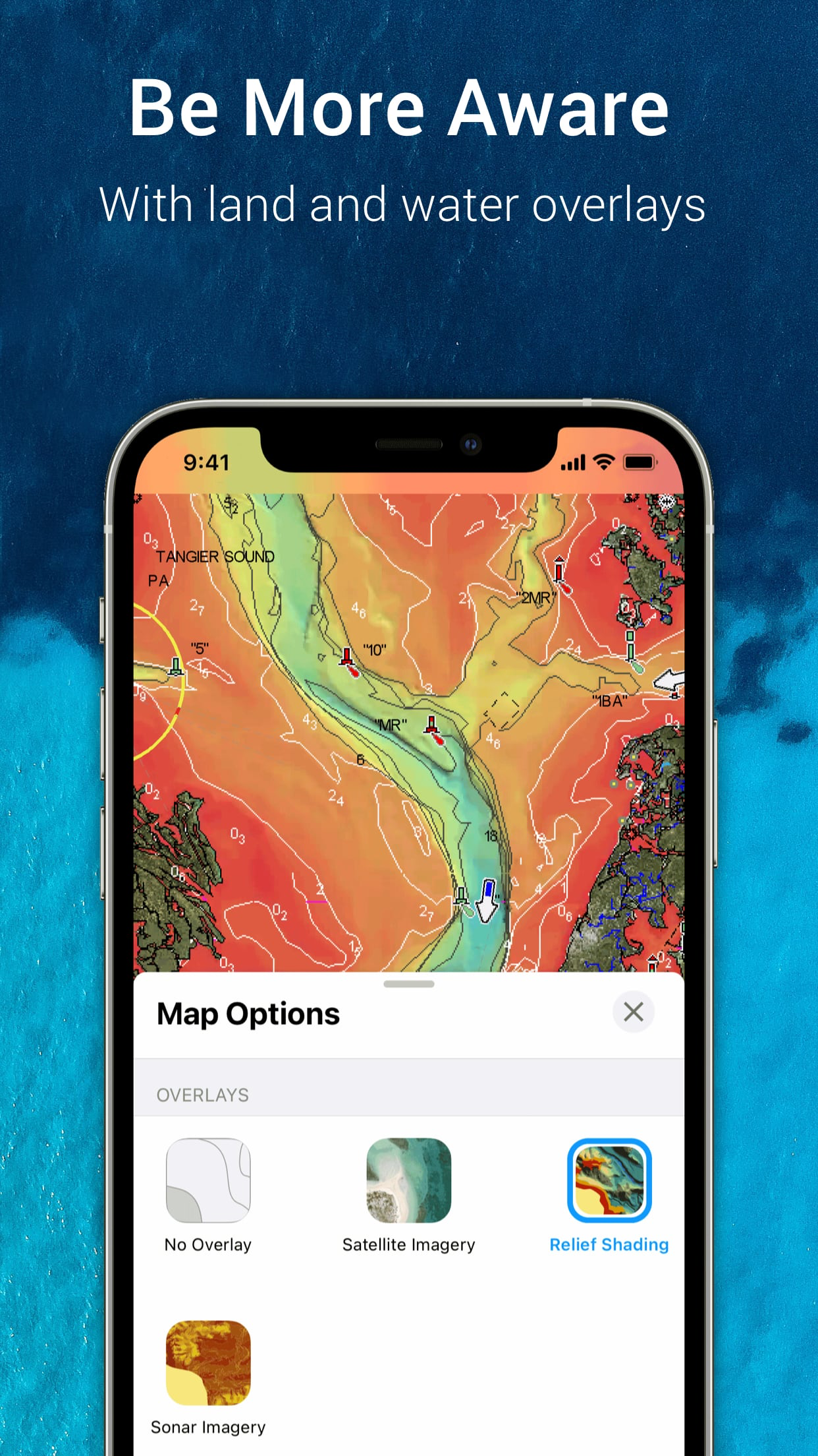
Screenshots


Questions & Answers
What's a good iOS app for checking lake depths and making sure I'm not about to run aground when I'm out on the water?
Okay, so I've been messing around with Navionics Boating, and for a no-fuss approach to checking lake depths, it's not bad. I mean, I'm too tired to l...
Ad — Extra Q&As are paid placements. Editorial standards apply; rankings unchanged.Learn more
Yo, what's the best iOS app for plotting out a boat trip down to the Keys and making sure I don't end up beached on some sandbar at 3am when inspiration hits?
Okay, so Navionics Boating is pretty clutch for planning any kind of boat trip, especially when you're cruising down to the Keys. The charts are super...
User Reviews
I did the trial periods on all the main boating navigation apps and finally settled on this one and paid for the one year subscription. The detailed contours of the coastal creeks near me are by far the best. I can confidently cruise around without running aground. Phone is on a suction cup mount with a battery charger, stays on for hours without issue. Tracks, auto routes, shows tides, wind, weather. Great app. Don’t understand the bad reviews, it’s better than the other apps for me. Includes coastal and inland all in one. Great for my skiff in coastal creeks I did the trial periods on all the main boating navigation apps and finally settled on this one and paid for the one year subscription. The detailed contours of the coastal creeks near me are by far the best. I can confidently cruise around without running aground. Phone is on a suction cup mount with a battery charger, stays on for hours without issue. Tracks, auto routes, shows tides, wind, weather. Great app. Don’t understand the bad reviews, it’s better than the other apps for me. Includes coastal and inland all in one.
I did the trial periods on all the main boating navigation apps and finally settled on this one and paid for the one year subscription. The detailed contours of the coastal creeks near me are by far the best. I can confidently cruise around without running aground. Phone is on a suction cup mount with a battery charger, stays on for hours without issue. Tracks, auto routes, shows tides, wind, weather. Great app. Don’t understand the bad reviews, it’s better than the other apps for me. Includes coastal and inland all in one. Great for my skiff in coastal creeks I did the trial periods on all the main boating navigation apps and finally settled on this one and paid for the one year subscription. The detailed contours of the coastal creeks near me are by far the best. I can confidently cruise around without running aground. Phone is on a suction cup mount with a battery charger, stays on for hours without issue. Tracks, auto routes, shows tides, wind, weather. Great app. Don’t understand the bad reviews, it’s better than the other apps for me. Includes coastal and inland all in one.
I use this app all the time on the water, my only complaint is how fast it deteriorates battery. I have an iPhone 15 max, I only get a few hours on the water because it eats it so fast. Fix this, and it’s the best. Great app… power drain I use this app all the time on the water, my only complaint is how fast it deteriorates battery. I have an iPhone 15 max, I only get a few hours on the water because it eats it so fast. Fix this, and it’s the best.
It’s the best pocket app for boating or quickly making a bathy chart, some things could use a little polishing however Still the top boating app It’s the best pocket app for boating or quickly making a bathy chart, some things could use a little polishing however
I use this app all the time on the water, my only complaint is how fast it deteriorates battery. I have an iPhone 15 max, I only get a few hours on the water because it eats it so fast. Fix this, and it’s the best. Great app… power drain I use this app all the time on the water, my only complaint is how fast it deteriorates battery. I have an iPhone 15 max, I only get a few hours on the water because it eats it so fast. Fix this, and it’s the best.
App Details
Developer
Garmin
Platform
iosRating
Last Updated
9/6/2025
Other Navigation Apps
Waze Navigation & Live Traffic
Waze Inc.
ParkMobile: Park. Pay. Go.
Parkmobile USA, Inc.
Transit • Subway & Bus Times
Transit App, Inc.
Shell: Fuel, Charge & More
Shell Information Technology International B.V.
SpotHero: #1 Rated Parking App
SpotHero, Inc.
ParkWhiz - #1 Parking App
ParkWhiz, Inc.