
by Avenza Systems Inc.
Detailed Review
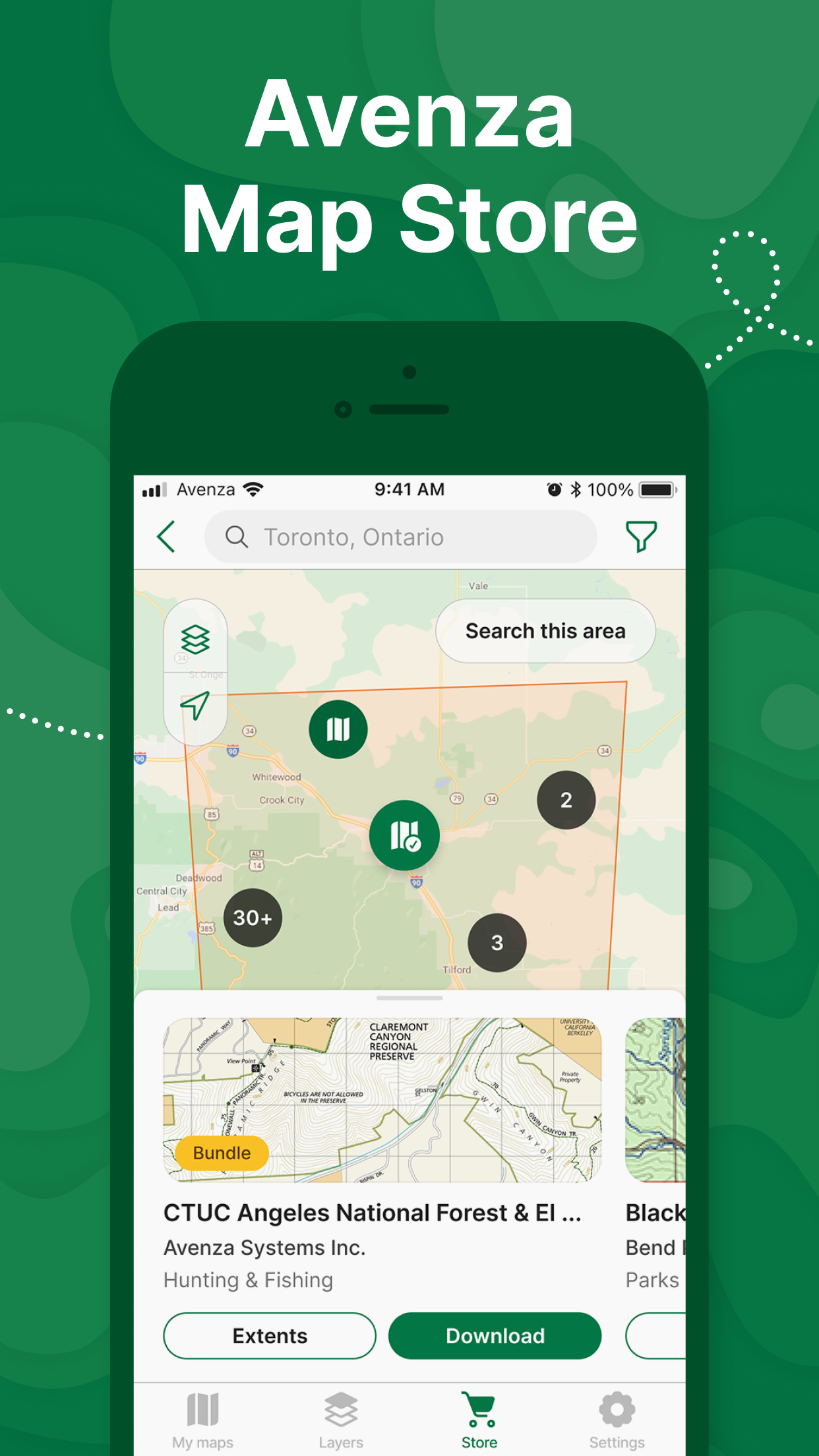
Key Features
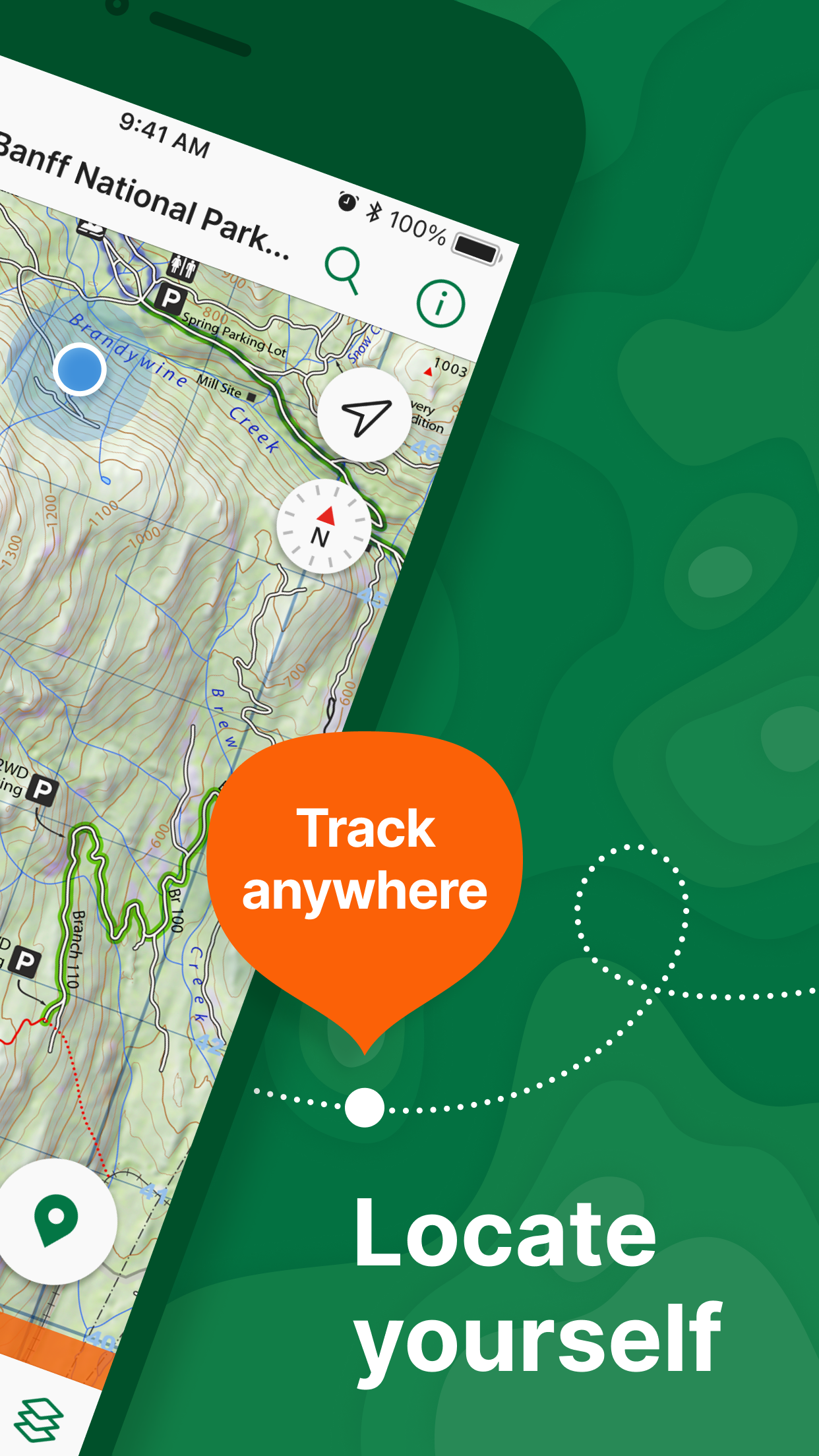
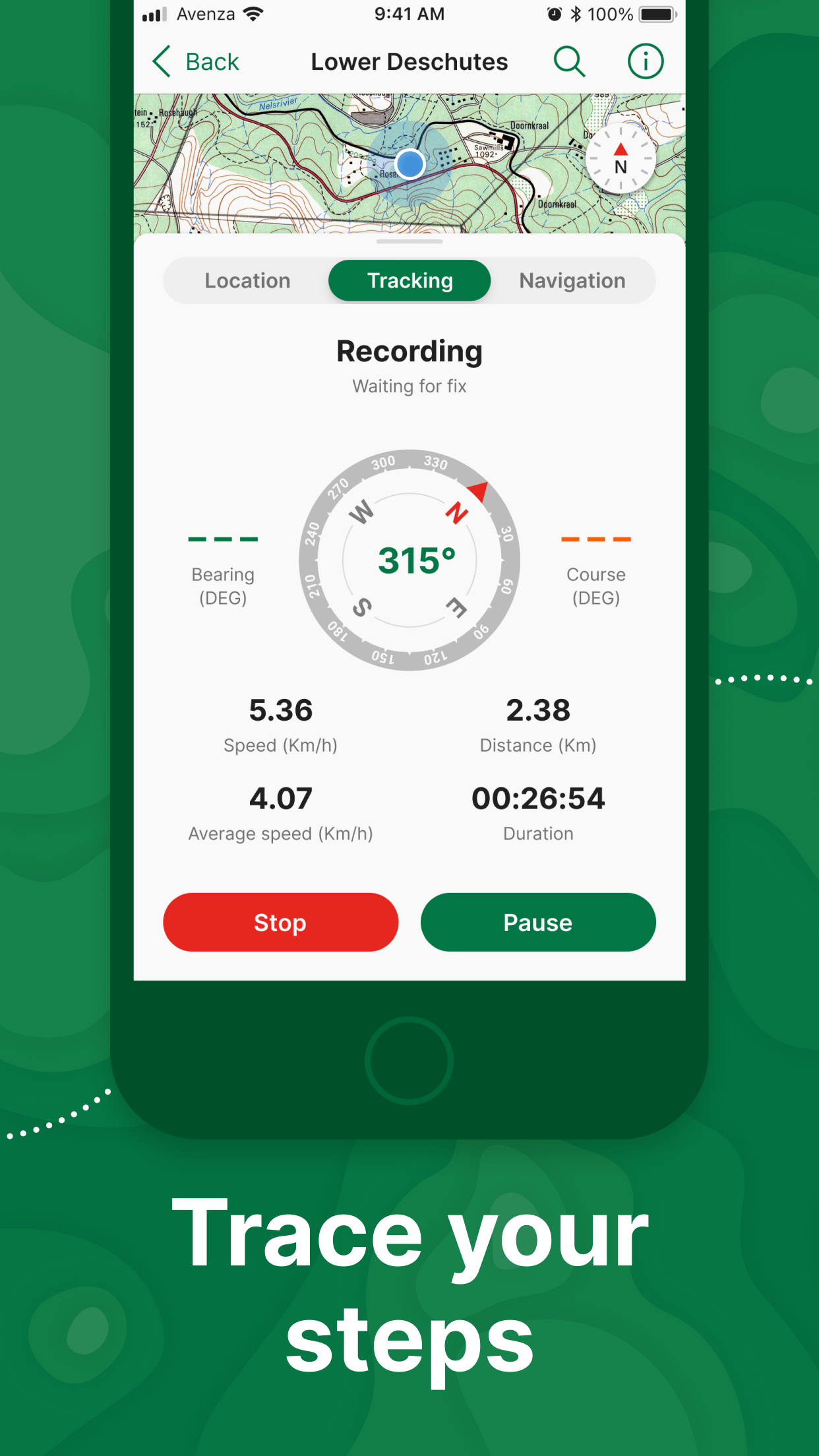
- •Offline GPS tracking maintains location accuracy without cellular service using device GPS capabilities
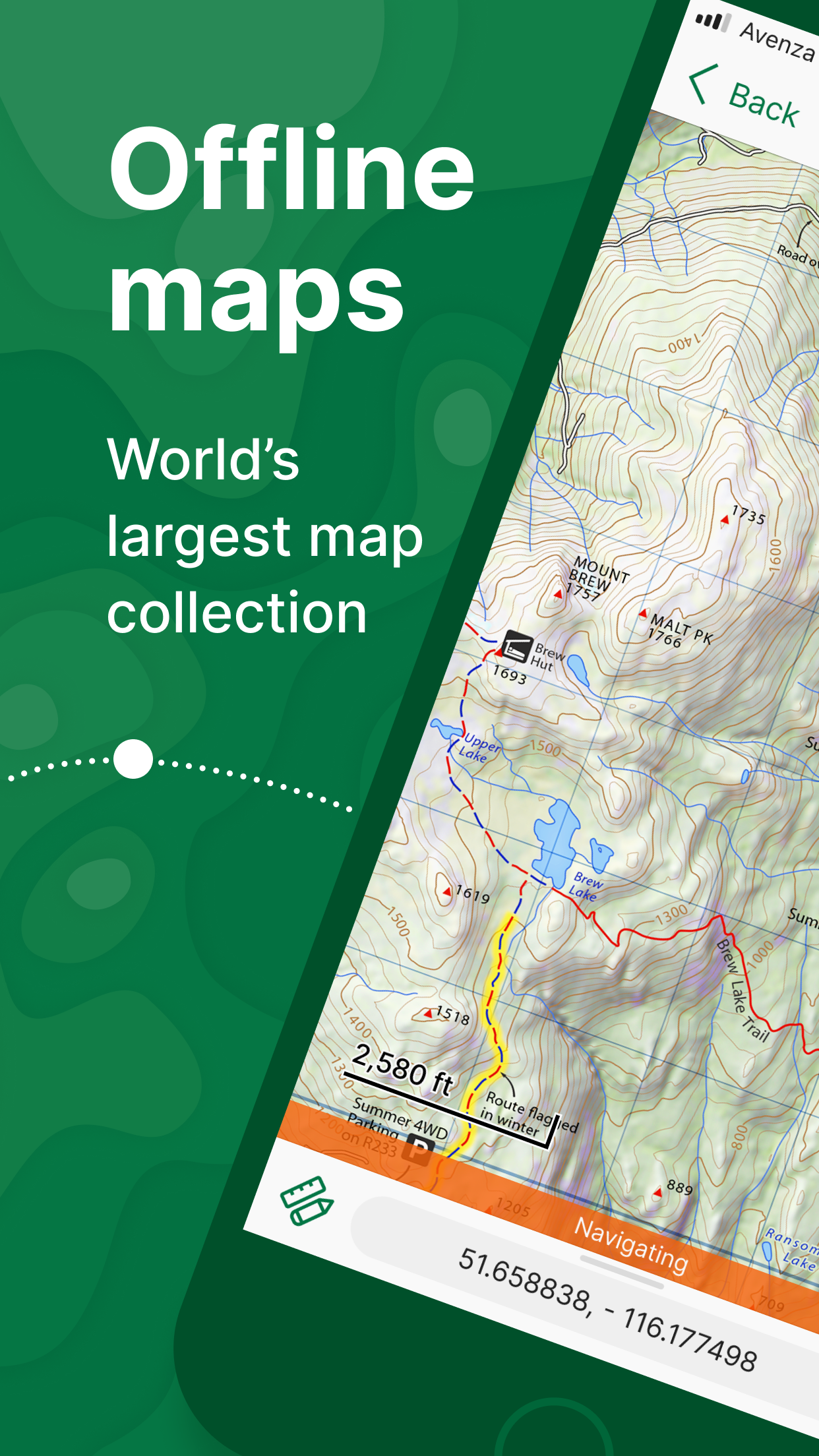
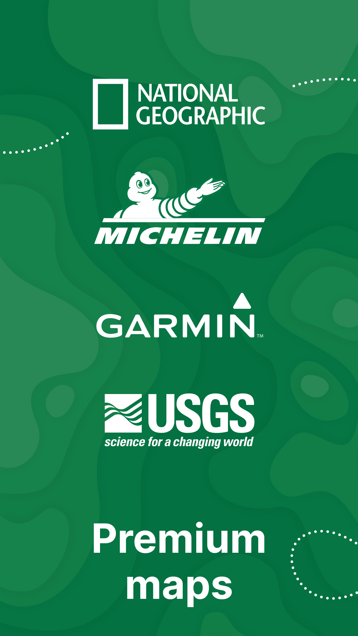
- •Professional map store features National Geographic, USFS, and NPS cartography for authoritative navigation
- •Custom map import supports KMZ, GeoTIFF and PDF formats for specialized mapping requirements
- •MVUM forest service maps provide legal motor vehicle use information for public lands
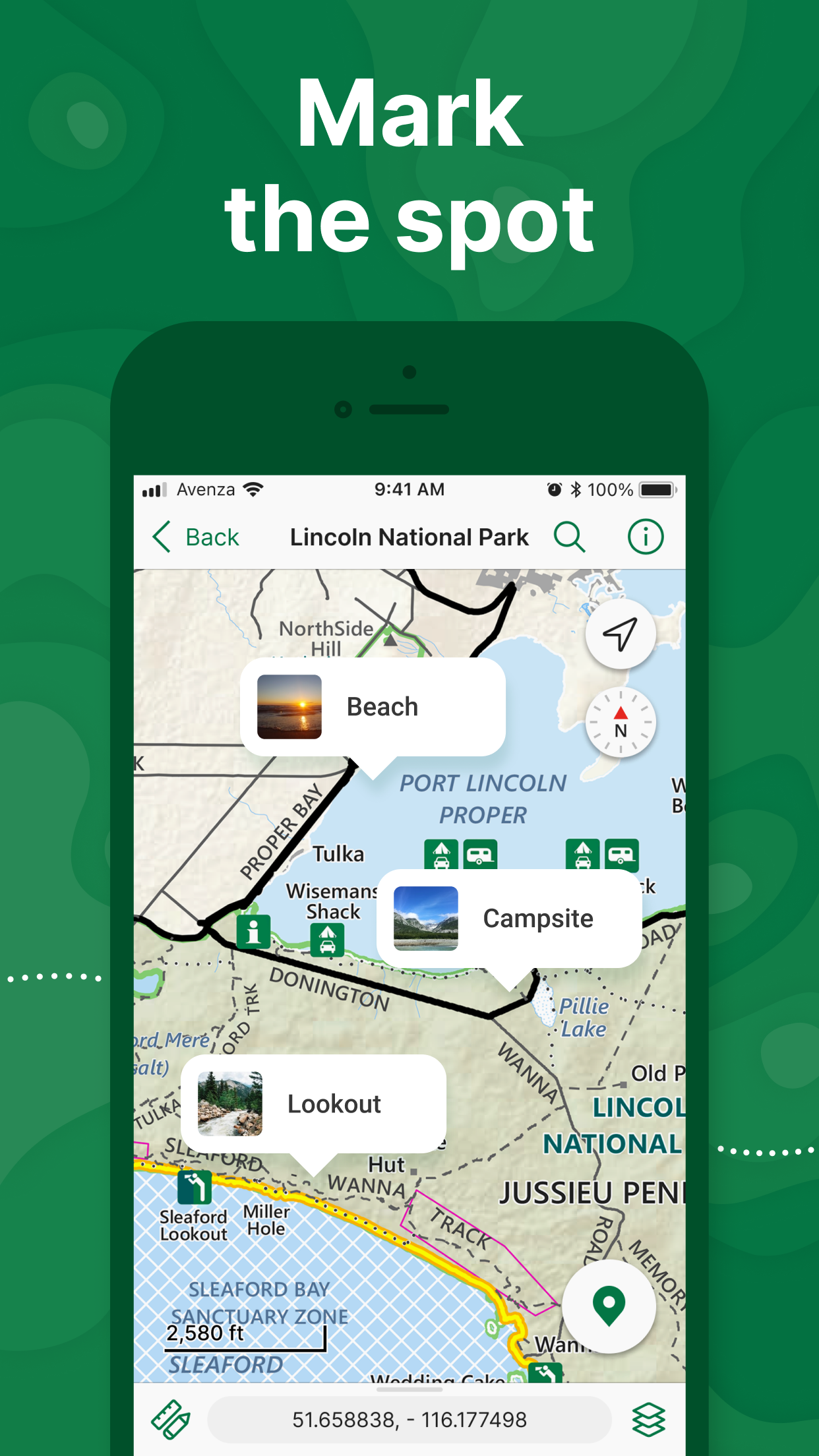
- •Real-time position marking shows exact location on downloaded maps during navigation
- •Free and paid map options include topographic and specialized maps for various activities
Why Users Love It
Perfect for: Outdoor enthusiasts and professionals requiring offline navigation
Screenshots
Ranking History
Track Avenza Maps: Offline Mapping's performance in Navigation over the last 30 days
Current Rank
#35
+4 from last week
Best Rank
#35
All-time high
Average Rank
#42
30-day average
Questions & Answers
What's the best iOS app for using detailed topographic maps completely offline while hiking?
Avenza Maps is a specialist navigation tool designed for situations where internet connectivity is unavailable. Its primary function is to import and ...
Ad — Extra Q&As are paid placements. Editorial standards apply; rankings unchanged.Learn more
What's the best iOS app for downloading offline maps with GPS enabled location to navigate hiking trails, camping spots, and remote areas without cell service?
Avenza Maps: Offline Mapping is excellent for downloading offline maps with GPS enabled location, enabling navigation on hiking trails, at camping spo...
What's a reliable iOS app for accessing geospatial PDF maps and performing fieldwork without needing a constant internet connection?
Avenza Maps offers an interesting implementation of offline map accessibility. As someone who frequently works on research projects in remote location...
User Reviews
Shows exact location with all the fire map info. I Really love camping and I’ve been using it for backwoods camping. It’s an amazing app, will be recommending for anyone doing any sort of camping. 10 out of 10 couldn’t ask for a better free map service. Love this app for fighting forest fires!! Shows exact location with all the fire map info. I Really love camping and I’ve been using it for backwoods camping. It’s an amazing app, will be recommending for anyone doing any sort of camping. 10 out of 10 couldn’t ask for a better free map service.
Tried them all and the only one we use now for trail riding. The best Tried them all and the only one we use now for trail riding.
Many quad maps are free download with gps enabled location, even with no cell service. Terrific! Many quad maps are free download with gps enabled location, even with no cell service.
What a fantastic mapping tool. I can’t recommend it highly enough. It’s very user friendly and easy to navigate, and the offline functionality works like a charm. I highly recommend Avenza. Fantastic app! What a fantastic mapping tool. I can’t recommend it highly enough. It’s very user friendly and easy to navigate, and the offline functionality works like a charm. I highly recommend Avenza.
Maps are easy to read. High quality. And best of all, you can map out your ride trail-to-trail. No other map can do that, that I’ve tried. Once ride is mapped out, you have distance traveling, which helps with planning destinations. It’s easy to follow and tracks your ride. Map Review Maps are easy to read. High quality. And best of all, you can map out your ride trail-to-trail. No other map can do that, that I’ve tried. Once ride is mapped out, you have distance traveling, which helps with planning destinations. It’s easy to follow and tracks your ride.
App Details
Developer
Avenza Systems Inc.
Platform
iosRating
Last Updated
1/7/2026
Other Navigation Apps
Waze Navigation & Live Traffic
Waze Inc.
ParkMobile: Park. Pay. Go.
Parkmobile USA, Inc.
Transit • Subway & Bus Times
Transit App, Inc.
Shell: Fuel, Charge & More
Shell Information Technology International B.V.
SpotHero: #1 Rated Parking App
SpotHero, Inc.
ParkWhiz - #1 Parking App
ParkWhiz, Inc.