
World Explorer 3D: Live Map: Comprehensive Android Navigation Tool Analysis
by Metuca Studio
0ANDROIDMaps & Navigation
World Explorer 3D offers real-time 3D Earth visualization with live traffic, street-level exploration, and camera security features. Targets travelers, geography enthusiasts, and security-conscious users seeking immersive mapping solutions.
Detailed Review
World Explorer 3D: Live Map positions itself as a comprehensive mapping solution that combines satellite imagery, 3D visualization, and real-time data integration. Developed by Metuca Studio for Android platforms, the application attempts to differentiate itself through its multi-layered approach to digital navigation, merging traditional mapping functions with contemporary features like camera security integration.
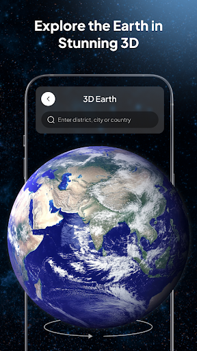
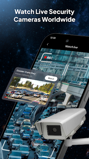
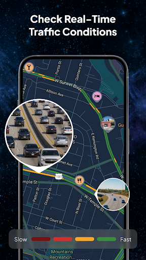
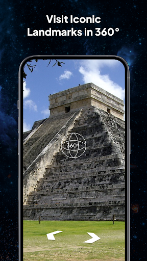
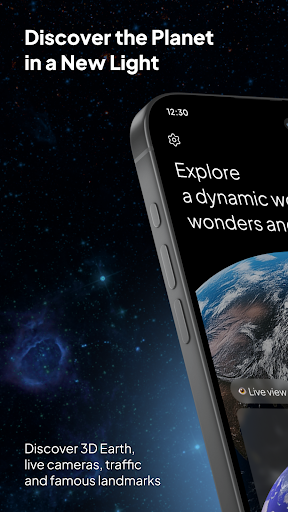
The application's core functionality revolves around its live 3D Earth visualization, which provides users with real-time satellite imagery and detailed topographic representations. The street-level exploration feature enables granular examination of urban environments, while live traffic updates offer practical routing assistance. The camera security component represents an unusual addition for mapping applications, potentially allowing users to monitor connected security cameras through the same interface used for navigation tasks.
User experience appears centered around a layered interface design where 3D mapping serves as the primary visual framework. Navigation controls follow conventional mapping application patterns with pinch-to-zoom functionality and drag-based exploration. The integration of multiple data streams—including satellite imagery, traffic information, and potential security feeds—creates a complex information environment that requires careful UI consideration to maintain usability.
With no user reviews currently available, the application's real-world performance remains unverified by public feedback. This absence of user validation makes objective assessment challenging, particularly regarding claims of 'real-time' data accuracy, rendering performance on various Android devices, and the practical implementation of the camera security feature.
The application demonstrates ambition through its feature combination but faces significant challenges in execution quality verification. Potential strengths include its multi-functional approach and 3D visualization scope, while limitations involve unproven reliability and the unusual pairing of navigation with security monitoring. Ideal usage scenarios might include urban planning visualization, travel preparation, and integrated property monitoring for users willing to test an unproven application combination.
Key Features
- •Real-time 3D Earth visualization providing immersive planetary exploration with detailed topographic rendering and satellite imagery integration
- •Live traffic updates offering practical routing assistance and congestion avoidance through continuously updated road condition data
- •Street-level exploration enabling detailed examination of urban environments with building-level detail and navigation precision
- •Camera security integration allowing monitoring of connected security cameras through the mapping interface for property surveillance
- •Zoom functionality supporting seamless transition from planetary-scale viewing to detailed location examination without interface switching
Why Users Love It
Comprehensive feature integration
Immersive 3D visualization
Perfect for: Travelers and security-conscious mapping enthusiasts
Screenshots

App Details
Developer
Metuca Studio
Platform
androidLast Updated
9/7/2025