
by onXmaps
Detailed Review
Key Features
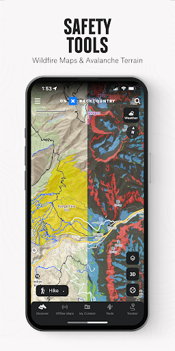
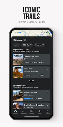
- •Offline topographic maps with slope angle shading for avalanche terrain assessment and route planning in steep environments
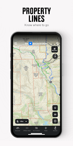
- •Land ownership boundary layers showing private/public land distinctions crucial for legal access and navigation
- •Custom waypoint plotting with cross-device synchronization between mobile and desktop platforms for trip planning
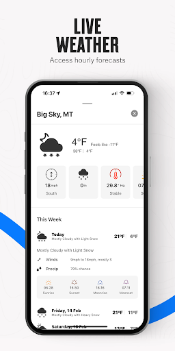
- •Real-time hazard layers including active wildfire perimeters and avalanche forecasts for safety considerations
- •High-precision GPS tracking maintaining accuracy in remote areas without cellular service coverage
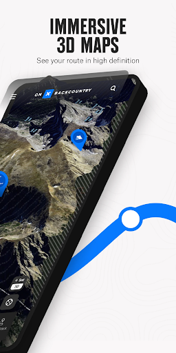
- •Multiple base map options including satellite imagery and specialized topographic renderings for different activities
Why Users Love It
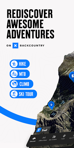
Perfect for: Serious backcountry hikers, climbers, and off-trail navigators requiring precision mapping
Screenshots
Ranking History
Track onX Backcountry Trail Maps GPS's performance in Sports over the last 30 days
Current Rank
#49
Best Rank
#49
All-time high
Average Rank
#50
30-day average
Questions & Answers
Which Android app works best for planning hiking routes with offline maps and land ownership information?
onX Backcountry Trail Maps GPS is specifically designed for backcountry navigation with comprehensive offline mapping capabilities. The app excels at ...
Ad — Extra Q&As are paid placements. Editorial standards apply; rankings unchanged.Learn more
What's a good Android app for finding hiking trails that also respects my privacy and helps me stay aware of my surroundings?
I appreciate onX Backcountry Trail Maps GPS because it seems mindfully designed. It allows you to download maps for offline use, which is wonderful fo...
Okay, so what's a good Android app for downloading detailed trail maps *before* I inevitably lose service? Gotta be design-forward, of course.
Seriously, the onX Backcountry app is a game-changer. We're talking detailed, downloadable maps – which, let's be real, is crucial when you're venturi...
User Reviews
Edited: I was contacted directly & offered technical support which fixed my issue. The response was quick & effective. Original: Really love the app's maps & Features I used the 7 day trial without any issues. started to prefer it over my "AllTrails". So I upgraded to the premium but the app now stops tracking 30 seconds in the screen turning off. Kinda really upset about it. I've been using AllTrails for 3 years and was about to fully switch over to this app. Not so sure now
Have just upgraded from the free version and am quite happy so far. Seems much easier to plot waypoints (used my laptop) than some other apps I've tried. I've now saved my map of waypoints to the app and downloaded it to my phone for offline use. Will go camping with it later this week and see how it works. I'm going to an area where I've gotten lost and wandered in the past so we'll see if I stay "found" this time, yet can "get lost" by choice.
I've used OnX backcountry for a year now and found it accurate and highly informative. And the Premium membership is worth the extra cost, at least for me. It shows private land ownership too, and it's pleasant to see the boundaries of my own 40 acres of forested land, and that of neighboring parcels with the owners' names provided (in case I want to add to my own land some day).
First time user of the app but it worked very well getting to trails in Zion National park...it also showed trails that I never knew about and I've been hiking there for years hitting all the popular well known trails but it found us some short hikes not many know about that where great hikes...also they gave me a discount the first year that was an offer I couldn't refuse...
worked great. these Forest Service trails are not marked very well. Sometimes you don't know if you're on the trail, or off on a cow trail. This app eliminates that worry.
App Details
Developer
onXmaps
Platform
androidRating
Last Updated
12/20/2025