
by JRustonApps B.V.
Detailed Review
Key Features
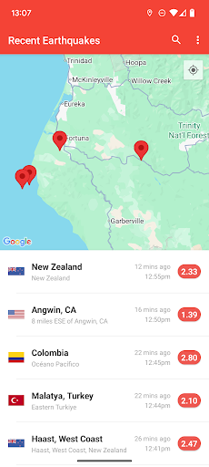
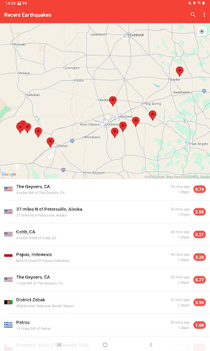
- •Live global earthquake map visualizing real-time seismic activity with color-coded magnitude indicators and interactive epicenter markers
- •Customizable push notifications allowing users to set magnitude thresholds and geographic radius for personalized alert delivery
- •Historical database searchable from 1970 onward with filters for date range, magnitude, and geographic coordinates
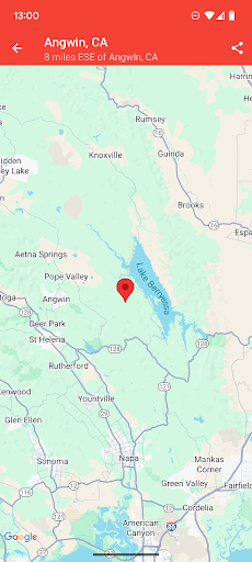
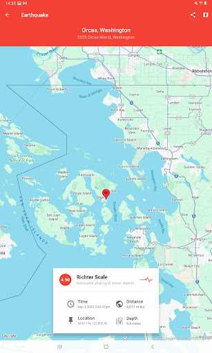
- •Detailed event pages providing depth measurements, coordinates, timestamp, and estimated affected region calculations
- •Offline functionality allowing cached access to recent alerts and stored historical search results without internet connection
Why Users Love It
Perfect for: Residents of seismically active regions and disaster preparedness professionals
Screenshots


Ranking History
Track My Earthquake Alerts - Map's performance in Weather over the last 30 days
Current Rank
#47
24 from last week
Best Rank
#12
All-time high
Average Rank
#33
30-day average
Questions & Answers
Which Android app is best for setting up personalized earthquake alerts based on location and magnitude?
My Earthquake Alerts is designed for users who need tailored earthquake monitoring, particularly those in seismically active regions. The app excels b...
Ad — Extra Q&As are paid placements. Editorial standards apply; rankings unchanged.Learn more
What's a good Android app for receiving real-time notifications about earthquakes worldwide?
My Earthquake Alerts - Map is a solid choice for staying informed about seismic activity around the world. The app excels at providing timely notifica...
User Reviews
It gave me an alert 5 seconds before a 6.9 magnitude earthquake and then a day later there was another 6.4 magnitude earthquake and it alerted me early so I'm very thankful.
It gave me an alert 5 seconds before a 6.9 magnitude earthquake and then a day later there was another 6.4 magnitude earthquake and it alerted me early so I'm very thankful.
i love it. its pretty accurate and i hope they will Improve this that there's an alarm feature when the user is near the earthquake.
i love it. its pretty accurate and i hope they will Improve this that there's an alarm feature when the user is near the earthquake.
i love it. its pretty accurate and i hope they will Improve this that there's an alarm feature when the user is near the earthquake.
App Details
Developer
JRustonApps B.V.
Platform
androidRating
Last Updated
11/22/2025
Other Weather Apps
Weather Now Launcher - Radar
Homescreen Apps
Live Weather: Daily Forecast
WINDWAVE LIMITED
1Weather Forecasts & Radar
OneLouder Apps
The Weather Channel - Radar
The Weather Channel
Nice Weather
Znd Digital
DailyWeather: Weather Forecast
SunnyTech Limited