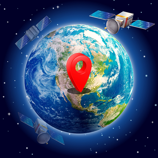
Live Satellite View, 3D Map: Comprehensive Review of Global Street Camera Access
by Banix Studio
Live Satellite View, 3D Map aggregates public CCTV feeds from global locations, offering real-time visual access to streets, traffic conditions, and weather patterns worldwide for travelers and curious observers.
Detailed Review
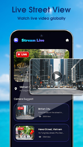
Live Satellite View, 3D Map positions itself as a gateway to real-time global observation by aggregating publicly accessible CCTV feeds from cities worldwide. The application's core premise revolves around providing users with immediate visual access to street-level activity across continents, from major metropolitan hubs to lesser-known locales. This approach distinguishes it from conventional mapping services by emphasizing live footage over static imagery or pre-recorded content.
The application's functionality centers on its extensive database of camera feeds, which reportedly includes thousands of sources across cities like New York, London, Seoul, and Dubai. These streams are presented with claims of high-definition clarity, enabling users to monitor real-time traffic patterns, weather conditions, and general street activity. The interface organizes cameras geographically, allowing users to navigate through a world map or search for specific locations. However, the actual availability and reliability of feeds vary significantly by region and local broadcasting regulations.
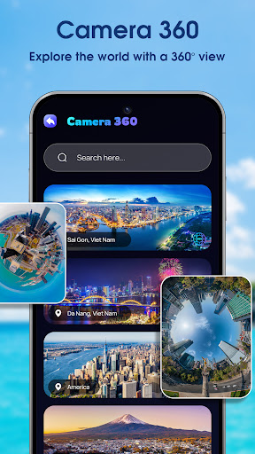
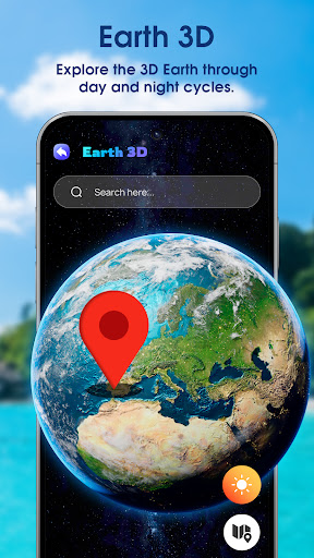
User experience is characterized by a straightforward interface with map-based navigation and categorized camera listings. The application performs adequately on modern Android devices, though streaming quality is inherently dependent on both the source feed's broadcast quality and the user's internet connection. Real-world usage patterns suggest primary utilization for trip planning, virtual tourism, and monitoring weather conditions in specific locations. The 3D mapping component provides basic topographical context but doesn't integrate deeply with the live camera functionality.
No user reviews are currently available for analysis, making independent verification of performance claims impossible. This absence of user feedback represents a significant limitation for potential users seeking unbiased perspectives on reliability, camera availability, or actual streaming quality across different regions and network conditions.
The application's primary strength lies in its ambitious scope of aggregated global camera feeds, while its limitations include unverified performance claims and potential variability in actual available content. It serves best as a supplementary tool for travelers seeking visual context about destinations or individuals interested in casual global observation, rather than as a reliable source for critical monitoring purposes.
Key Features
- •Global CCTV aggregation providing access to thousands of public street cameras across major cities and remote locations worldwide
- •Real-time streaming capability delivering live footage with claimed high-definition clarity for immediate situational awareness
- •Interactive world map interface enabling geographical navigation and quick access to camera feeds by location
- •Weather monitoring functionality through visual observation of current conditions in various global locations
- •Traffic condition assessment allowing users to visually evaluate road situations and congestion patterns internationally
Why Users Love It
Extensive global camera coverage
Real-time visual access
Perfect for: Travel planners and virtual explorers seeking live street-level views
Screenshots

App Preview
Ranking History
Track Live Satellite View, 3D Map's performance in Maps & Navigation over the last 30 days
Top 5
Top 10
Top 15
Below 15
Current Rank
#49
→
Best Rank
#40
All-time high
Average Rank
#46
30-day average
Questions & Answers
What's the best Android app for scouting hiking trails with interactive 3D terrain maps?
Live Satellite View, 3D Map is a practical tool for hikers and outdoor enthusiasts seeking to preview trails and natural features in three dimensions....
Read full answer →
Ad — Extra Q&As are paid placements. Editorial standards apply; rankings unchanged.Learn more
What's a good Android app for exploring the world with live satellite imagery, viewing street maps in 3D, and getting real-time views of global locations?
Live Satellite View, 3D Map is a useful Android application for exploring the world from your mobile device. It offers live satellite imagery, allowin...
Read full answer →
App Details
Developer
Banix Studio
Platform
androidRating
★3.0
Last Updated
12/15/2025