
Exploring Live Earth Map: Satellite View for Android
by Galixo L.L.C-FZ
This app delivers satellite imagery for on-the-go Earth exploration. If you need a tool for visualizing global geography or casual map browsing, it offers accessible aerial perspectives. A practical option for users seeking basic satellite views without complex features.
Detailed Review
Live Earth Map: Satellite View by Galixo L.L.C-FZ enters the crowded maps and navigation space as an Android application focused on providing satellite-based visualizations of Earth. Unlike comprehensive navigation suites, it zeroes in on aerial imagery, appealing to users who prioritize visual exploration over turn-by-turn directions. The app's positioning targets a niche audience interested in geography, education, or simple virtual travel, competing with established services by emphasizing straightforward satellite access.
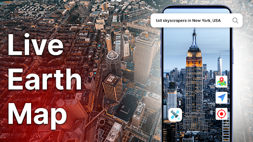
Core functionality revolves around high-resolution satellite photos sourced from various providers, enabling zoom levels that reveal details like buildings and natural landscapes. Users can search for specific addresses or coordinates, with options to toggle between different map styles, though the availability of real-time data may vary. Additional features include a compass mode for orientation and basic measurement tools for estimating distances. However, the absence of advanced navigation aids like route planning or traffic updates limits its utility for daily commuting, positioning it more as a supplementary tool.
In real-world usage, the app performs adequately on mid-range Android devices, with responsive touch controls for panning and zooming. Load times for high-detail imagery can be sluggish in areas with poor internet connectivity, and the interface, while clean, lacks customization options found in competitors. For instance, educators might use it in classrooms to demonstrate geographical concepts, while travelers could preview destinations, though the experience is hampered by occasional lag during image rendering. The ad-supported model introduces banners that some find distracting during extended sessions.
User feedback is sparse due to the absence of published reviews, but the 2.9-star rating suggests recurring issues, potentially related to data accuracy or performance inconsistencies. In similar apps, low ratings often correlate with outdated imagery or intrusive advertisements, which could explain the muted reception. Without specific testimonials, potential adopters should approach with caution, testing the app for their use cases to assess reliability.
Overall, Live Earth Map serves as a functional entry-level option for satellite view enthusiasts, offering decent imagery without subscription fees. Its main drawbacks include limited features and potential performance hiccops, making it suitable for casual use rather than professional applications. For those valuing simplicity over sophistication, it provides a passable experience, though power users may prefer more robust alternatives.
Key Features
- •High-resolution satellite imagery allows detailed viewing of global locations, useful for educational or recreational exploration without requiring advanced technical knowledge.
- •Search and zoom functionality enables quick navigation to specific addresses or landmarks, supporting basic geographic research and virtual travel planning.
- •Compass and orientation tools help users align maps with real-world directions, enhancing outdoor activities like hiking or site inspections.
- •Multiple map style toggles let users switch between satellite and standard views, offering flexibility for different visual preferences and use cases.
- •Basic distance measurement features provide rough estimates between points, assisting in planning trips or understanding spatial relationships.
- •Offline caching for previously viewed areas ensures access to maps without constant internet, though data updates may be infrequent in some regions.
Why Users Love It
Free access to satellite views
Simple, intuitive interface
Perfect for: Ideal for students, hobbyists, and casual users interested in exploring Earth's geography through satellite imagery.
Screenshots


App Details
Developer
Galixo L.L.C-FZ
Platform
androidRating
★2.9
Last Updated
11/15/2025