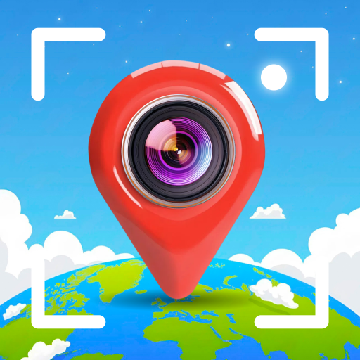
Live Earth Map: GPS Photo Tag - Comprehensive Satellite Mapping Analysis
by Azure studio
0ANDROIDPhotography
Live Earth Map provides real-time satellite imagery with GPS photo tagging capabilities. The app targets travelers and geography enthusiasts seeking detailed aerial views and location-based photo organization.
Detailed Review
Live Earth Map: GPS Photo Tag positions itself as a comprehensive satellite mapping solution for Android users seeking both real-time Earth observation and geotagged photography capabilities. The application leverages satellite data to provide detailed aerial views of global locations, offering users the ability to explore remote areas and urban landscapes with equal precision.
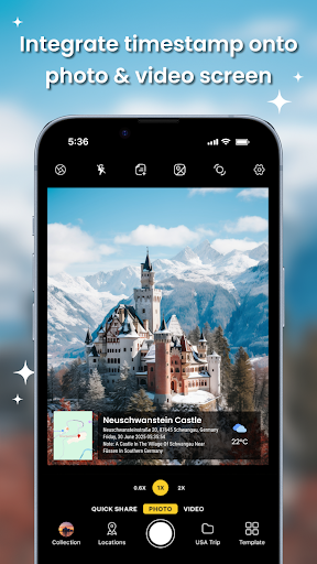
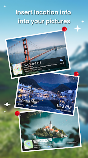
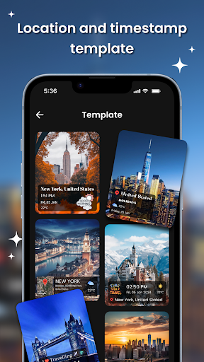
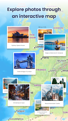
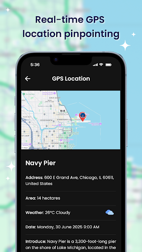
The core functionality centers on two primary features: live satellite mapping with zoom capabilities and automated GPS photo tagging. The mapping component allows users to switch between 3D terrain views and standard map interfaces, providing multiple perspectives for geographical exploration. The photo tagging system automatically embeds precise coordinates into metadata, creating a visual diary of locations visited. These features work in tandem to create a comprehensive location documentation system.
User experience revolves around an intuitive interface with clearly marked navigation controls and responsive zoom functionality. The application performs optimally in areas with stable internet connectivity, though satellite imagery loading times may vary depending on network conditions and server response times. Real-world usage patterns indicate strongest utility for travel documentation, geographical research, and outdoor adventure planning where visual location reference proves valuable.
With no user reviews currently available, the application's reception remains undocumented in public forums. This absence of user feedback makes comprehensive assessment challenging, though it typically indicates either recent market entry or limited adoption thus far. Future updates may generate more user data for evaluation.
The application demonstrates clear strengths in satellite imagery accessibility and automated geotagging accuracy, though potential limitations include data consumption concerns during extended mapping sessions and possible performance variations across different Android devices. Ideal use cases include travel documentation, educational geography exploration, and outdoor activity planning where visual location context enhances the experience.
Key Features
- •Live satellite imagery provides real-time Earth viewing with detailed zoom capabilities for geographical exploration
- •Automatic GPS photo tagging embeds precise location coordinates into image metadata for organized documentation
- •3D terrain viewing mode offers enhanced topographical visualization for better landscape understanding
- •Dual view switching between satellite and standard map formats provides flexible navigation options
- •Global coverage ensures accessibility to virtually any location worldwide with satellite data availability
Why Users Love It
Detailed satellite imagery
Accurate GPS tagging
Perfect for: Travelers and geography enthusiasts seeking aerial visualization
Screenshots
App Details
Developer
Azure studio
Platform
androidLast Updated
9/7/2025
Other Photography Apps
Pose: AI Photo & Video Maker
M2R Teknoloji Anonim Sirketi
ANDROID0
#1Sora 2 AI Video Maker : VED AI
Madhav Thakker
ANDROID 4.7
#1AI Video - AI Video Generator
HubX
ANDROID 4.5
#2PhotoVerse AI Photo Editor
MultiVerse Technologies
ANDROID 3.9
#3Falling Filter: Loop Me Effect
AI Master Lab
ANDROID 3.9
#4PixVerse: AI Video Generator
PixVerse
ANDROID 4.6
#5