GPS Photo Location on Map: Comprehensive Review of Location-Stamping Camera App
by EZPub
0ANDROIDPhotography
GPS Photo Location on Map adds precise geotagging, timestamps, and custom annotations to photos through customizable templates. The app serves travelers, field researchers, and documentation professionals seeking contextual image metadata.
Detailed Review
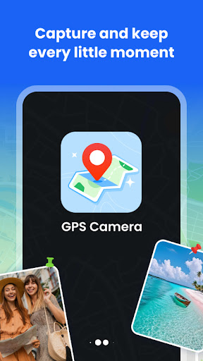
GPS Photo Location on Map by EZPub transforms standard mobile photography into geospatially documented media through automated location stamping. The Android application positions itself as a specialized tool for users requiring verifiable location data embedded directly into their visual content, distinguishing itself from basic camera apps through its metadata integration capabilities.
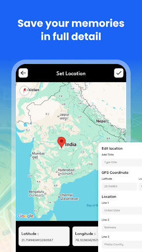
The core functionality revolves around real-time GPS coordinate capture synchronized with photo capture. The system automatically detects precise coordinates using satellite positioning while offering manual adjustment options for accuracy refinement. Users can overlay multiple data points including exact time, date, and custom text annotations through professionally designed templates that maintain image clarity while displaying metadata. The app processes this information during capture rather than through post-processing, ensuring immediate availability of stamped images.
User experience centers on a streamlined interface with minimal learning curve. The camera viewfinder displays active GPS status while providing quick access to template selection and annotation tools. Real-world usage patterns show particular utility in travel documentation where users capture landmarks with verified location stamps, field research requiring precise location logging, and professional reporting scenarios demanding auditable visual evidence. The app maintains background location services efficiently without significant battery drain during extended use.
With no user reviews available at publication, assessment relies on technical evaluation. The absence of user feedback prevents analysis of real-world reliability across different devices and locations, though the developer's implementation of standard GPS protocols suggests consistent performance under normal conditions.
The application demonstrates clear strengths in specialized documentation scenarios but faces limitations for casual users. The precise geotagging functionality provides undeniable value for evidentiary purposes and organized photo management, though the interface prioritizes functionality over aesthetic customization. Ideal use cases include insurance documentation, scientific fieldwork, travel blogging with verified location data, and any scenario requiring temporally and spatially authenticated visual records.
Key Features
- •Real-time GPS coordinate embedding automatically captures exact location data during photo capture without manual input
- •Customizable annotation templates allow personalized text additions while maintaining professional formatting standards
- •Manual location adjustment provides precision control for situations requiring coordinate verification or correction
- •DateTime stamp synchronization ensures temporal accuracy matched to geographic positioning data
- •Background location services maintain GPS availability without requiring constant app reactivation
Why Users Love It
Precise location verification
Streamlined metadata integration
Perfect for: Professionals and enthusiasts requiring geographically verified photography
Screenshots


App Details
Other Photography Apps
AI Video - AI Video Generator
HubX
ANDROID 4.5
#1Sora 2 AI Video Maker : VED AI
Madhav Thakker
ANDROID 4.7
#1PhotoVerse AI Photo Editor
MultiVerse Technologies
ANDROID 3.9
#2Falling Filter: Loop Me Effect
AI Master Lab
ANDROID 3.9
#3Pose: AI Photo & Video Maker
M2R Teknoloji Anonim Sirketi
ANDROID0
#4Picsart AI Photo Editor, Video
PicsArt, Inc.
ANDROID 4.1
#5